Place Comment: Len Beadell Stone Cross Marker
Submitted: Sunday, Jun 24, 2018 at 23:12
ThreadID:
136892
Views:
4259
Replies:
3
FollowUps:
3
This Thread has been Archived
Candace S.
Regarding this survey mark with the stone cross... I saw dozens of similar survey markers along the AB from
Mabel Creek Station to Emu, as
well as in the Emu area. Some of them are marked with stone crosses, some with stone circles around them. In some cases the survey mark it simply a little nub; sometimes it is a larger medallion. I had the idea they (as
well as the several trig points I saw) were built during a survey conducted after the tests. Two of the trig points I visited were dated 1962. Was Len Beadell involved in these later surveys?
Reply By: Allan B (Sunshine Coast) - Monday, Jun 25, 2018 at 11:10
Monday, Jun 25, 2018 at 11:10
.
Hi Candace,
Len Beadell established the locations for both Emu Field and
Maralinga together with the "Beadell Roads" associated with those locations and for the
Woomera rocket range.
Beadell placed numerous location plaques of aluminium plate bearing the details. He also erected some trig points and would have placed some progressive reference points without plaques. Further detailed surveying by others, particularly on the
test ranges rather than roads, was carried out by military and departmental personnel.
The two trig points you visited were most likely not erected by Beadell.
The aluminium plaques of today are replicas installed by the Beadell family in response to theft of the original plaques.
Further markers have been placed during later surveys along the Ann Beadell and other roads subsequent to the atomic and missile tests by civilian organisations, e.g. mining, pastoral and government. These are usually star pickets with non-explanatory markings.
Len Beadell and his team began work in this area in 1947 and completed it in 1963. You may find the map below of his roads of interest.
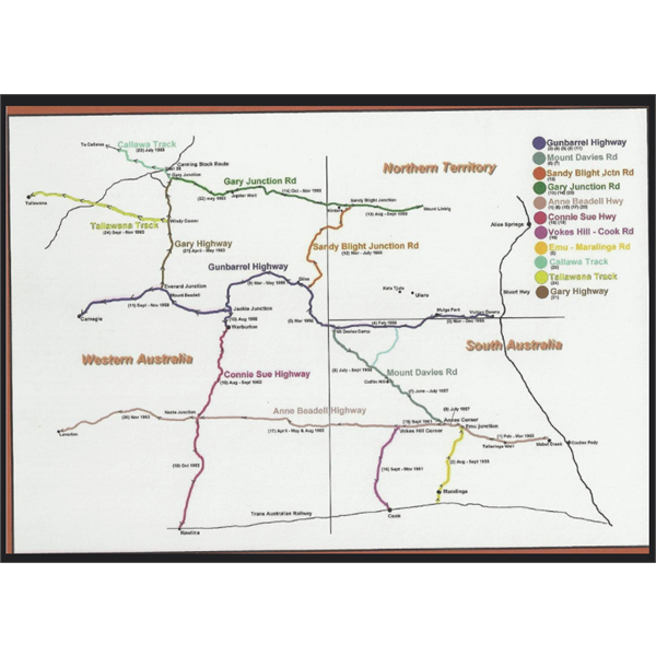
Beadell Roads
AnswerID:
619783
Reply By: Member - Phil G (SA) - Tuesday, Jun 26, 2018 at 09:36
Tuesday, Jun 26, 2018 at 09:36
I have no idea about Lens Involvement with survey marks placed out there.
But they are called Benchmarks, or these days the SA Government calls them Permanent Survey Marks (PSM) and you will find them all over South Australia. I believe the cross of white painted rocks make them visible from aerial or satellite photographs
Benchmarks are signified by BM and a number which are used to record altitude levels or spot heights.
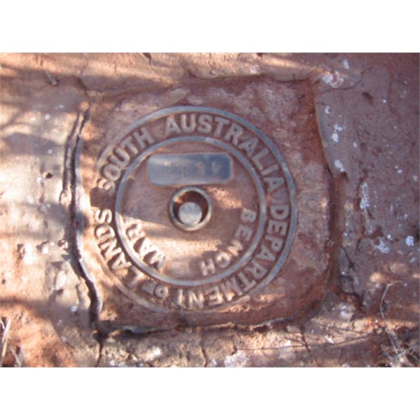
Benchmark
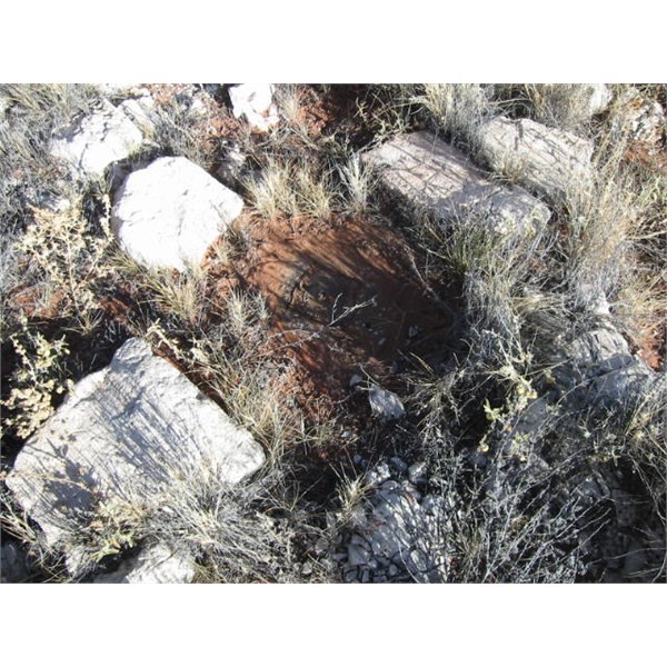
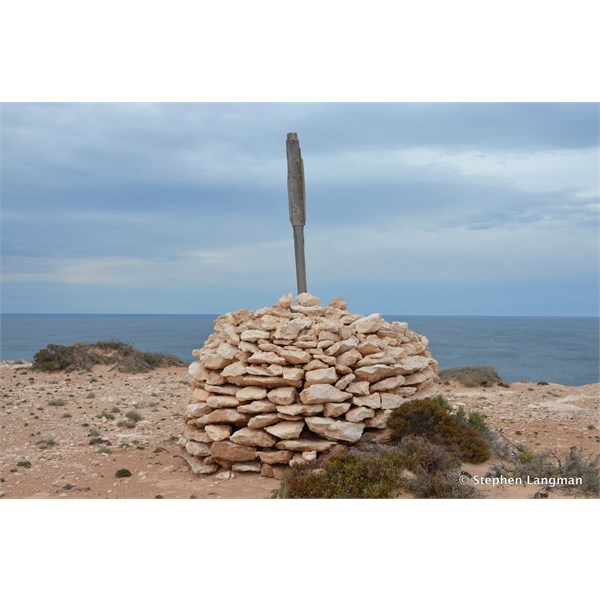
Benchmark will be buried under the centre of the cross
Post with location sign at a Benchmark on the Anne Beadell Highway
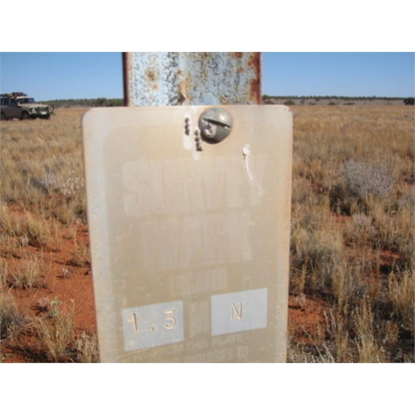
The other type is the tower with an NME number which is a registered survey point providing latitude and longitude data. NM is National Mapping and E is the letter used to signify South Australia.
NME markers were introduced in the 1950s when the Commonwealth Govt embarked on the National Series of 1:1,000,000 scale topographic maps
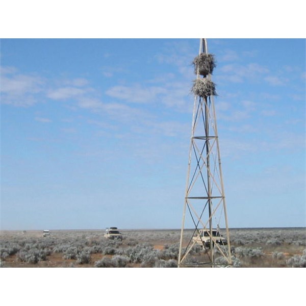
NME tower on Cook to Voakes Hill Rd

NME survey marker
In years gone by before GPS 4wders could use these markers to determine your exact location as they were featured on the Auslig maps.
AnswerID:
619793
Follow Up By: Candace S. - Wednesday, Jun 27, 2018 at 21:47
Wednesday, Jun 27, 2018 at 21:47
Thanks for the info. I've not yet come across one of those NME towers, but perhaps some day I will. :)
FollowupID:
892150
Reply By: Member - Stephen L (Clare SA) - Tuesday, Jun 26, 2018 at 20:17
Tuesday, Jun 26, 2018 at 20:17
Hi Candace
Survey
Cairns, and survey markers are special to me for a number of reason
Her is now a piece of Survey History that very few Australians will know and something that you would not be aware of as you are from America.
In May 1837, Colonel Light was the first surveyor in the world to use trigonometrical surveys to fix property boundaries and to lay out the proportions for the future suburbs of the new Colony of South Australia and was far more accurate than using the standard chain survey that was common practice until then.
The first surveyors to the remote parts of South Australia in the Mid 1800's built their survey
Cairns on high ground so that point could be used as a reference point for future surveys in the area, and as such these old survey
cairns are so special.
In relation the
the Bench Marks that you witnessed along your travel of the Anne Beadell, they were carried out by the Australian Army Survey Corps, where as
the Bench Marks along the
Maralinga to Emu tracks were carried out by the South Australia Department of Lands.
Each state in Australia carries out their own surveys and they are all number and logged for future reference.
One of my sons is a Licensed Surveyor and I would have given my right arm for some of the
places where he has carried out surveys, from surveying old World War 11 air strips in the Solomon Islands to remote surveys in the
Pilbara, surveying future mining leases and new railway lines.
I could go on and one, but will let the photos tell their own story.
Cheers
Stephen
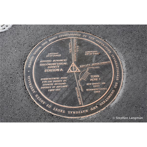
Trig Station A in Adelaide by Colonel Light was the first surveyor in the world to use trigonometrical surveys
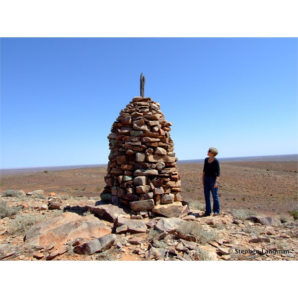
1869 Survey Cairn in the Flinders Ranges
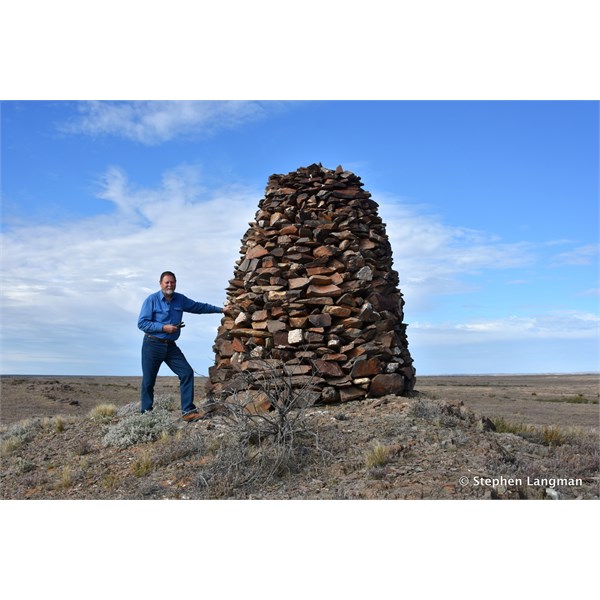
1880's Survey Cairn south of Marree
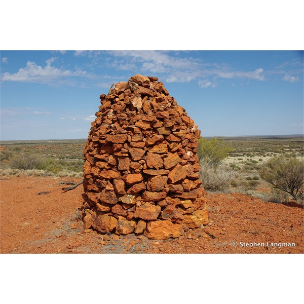
Old Survey Cairn at Mt Samual Western Australia
Old Survey Cairn on the Old Gunbarrel Highway
Old Survey Cairn on the far West Coast of South Australia
Old Survey Cairn west of Laverton WA
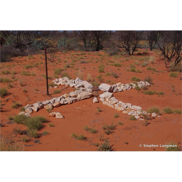
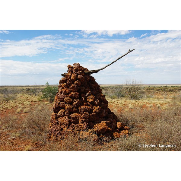
Stone Cross marking at Bench Mark on the Anne Beadell
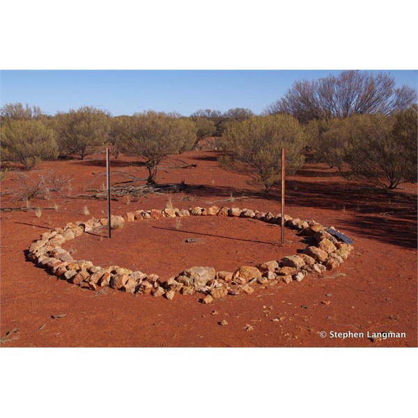
Stone Circle marking a Bench Mark on the Anne Beadell Highway
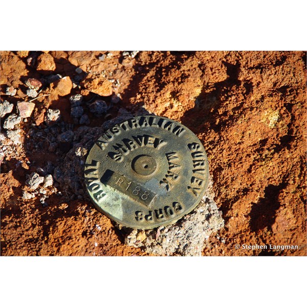
Australian Army Survey Corps Bench Mark on the Connie Sue Highway
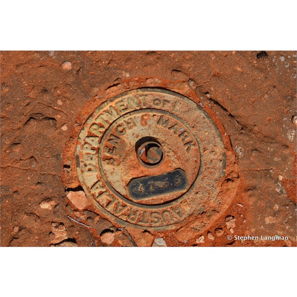
Department of Lands Survey Bench Mark on the Emu Road
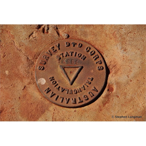
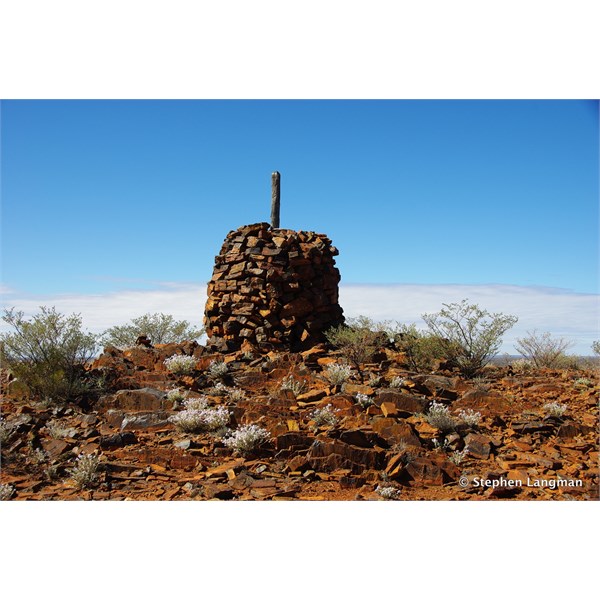
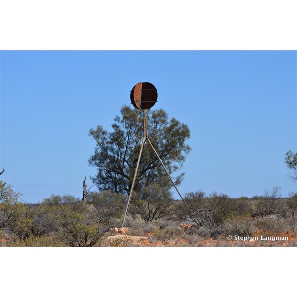
Australian Army Survey Corps Trig Point marker on the Anne Beadell Highway
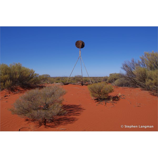
Anne Beadell Highway Trig Station
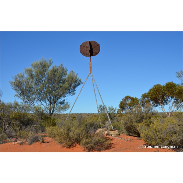
Old Survey Trig Station out in the scrub at Maralinga
You should have seen this Trig Station on the Maralinga Range Tour
AnswerID:
619805
Follow Up By: Member - McLaren3030 - Wednesday, Jun 27, 2018 at 12:12
Wednesday, Jun 27, 2018 at 12:12
Great photos & info as always Stephen.
Macca.
FollowupID:
892141
Follow Up By: Candace S. - Wednesday, Jun 27, 2018 at 21:56
Wednesday, Jun 27, 2018 at 21:56
Stephen,
Thanks for all the pics and info.
I saw (and photographed with zoom lens) two
cairns on different hilltops, as I was finishing the
Birdsville Track and nearing
Marree Same with another one I saw later that day, while I was on the
Oodnadatta Track.
Indeed, I saw two of Len's trig points while I was at
Maralinga: The one on the tour, and another in the village area near the old radar ramp. :)
FollowupID:
892151